Public Realm Transformation for Improved Access: Learnings From Fort Kochi's RoRo Jetty
by -
Look anywhere in a city and you will see more people on foot than in cars. Yet city roads and urban public spaces are rarely designed keeping pedestrians in mind, making it particularly challenging for children and the elderly. Integrating street infrastructure and raising user awareness is key to improving accessibility and enabling safer and smoother pedestrian and vehicular movement.
The Reimagining Fort Kochi project, developed under the Transformative Urban Mobility Initiative is working to improve accessibility at the RoRo jetty node in the Fort Kochi area. The node is a critical and affordable entry point to the city from Ernakulam and Vypin island that caters to both people on foot and in vehicles.
The project demonstrated a stakeholder-led process for adopting Tactical Urbanism, a quick, cost-effective, temporary intervention to enhance neighbourhoods and improve public spaces, as a tool for public engagement. Inputs from this engagement resulted in a proposal that was further assessed to inform permanent implementation.
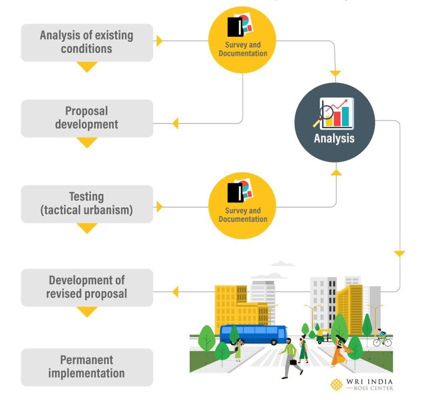
This photo story intends to give an overview of this case, the processes that were adopted in this project and its various outcomes.
Analysis of Existing Conditions
The RoRo jetty node lacks proper planning and infrastructure resulting in congestion issues, vehicular-pedestrian conflicts, and underutilized public spaces. The existing scenario was documented and analyzed through surveys like traffic and pedestrian volume count, parking study, public transport usage and user perception study to understand the issues and employ learnings. Here are the findings from this analysis:
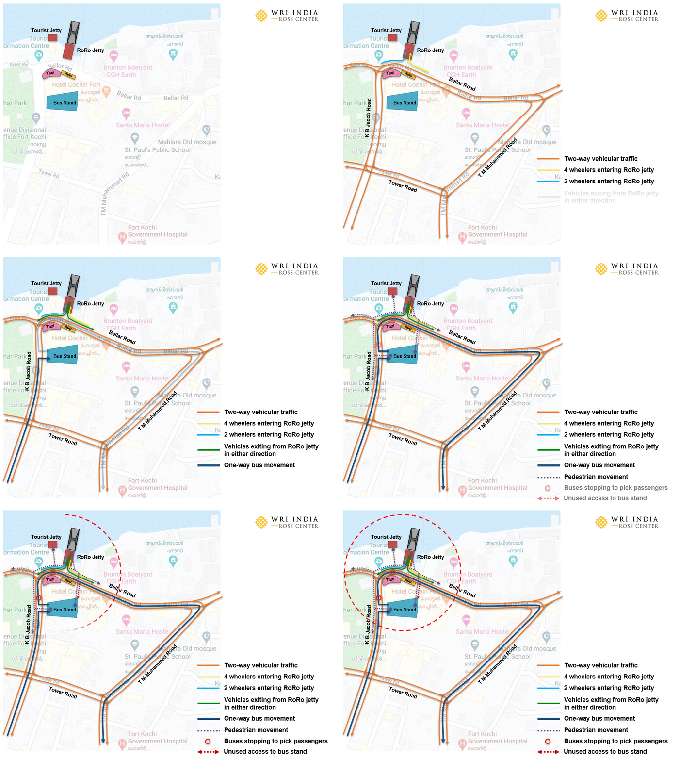
- The two-way circulation, uneven carriageway and lack of segregated transit entry/exits permit varying volumes of vehicular movement causing conflicts and congestion.
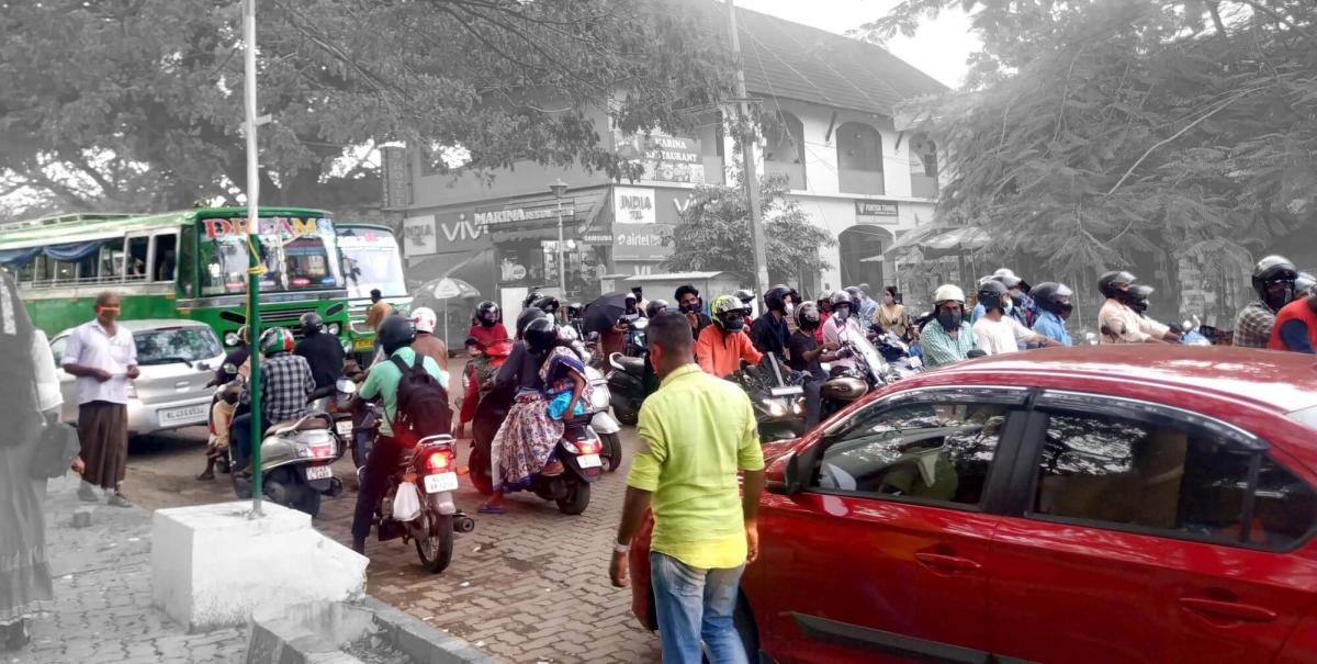
Traffic congestion at the RoRo Jetty entry. Photo by Shabna Seemamu/WRI India - The lack of continuous footpaths and street crossings, results in haphazard movement of pedestrians and their spillage onto the carriageway.
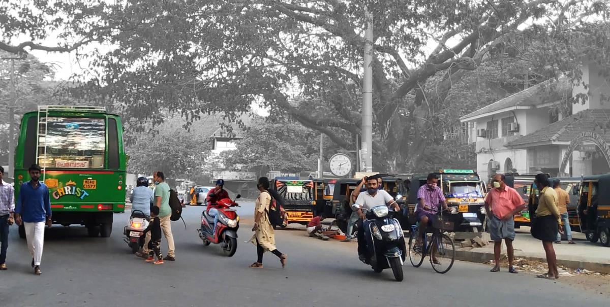
Pedestrian-vehicle conflict at the Jetty transit point. Photo by Shabna Seemamu/WRI India - The existing open spaces are either underused or have been encroached upon due to a lack of defined access, function and maintenance.
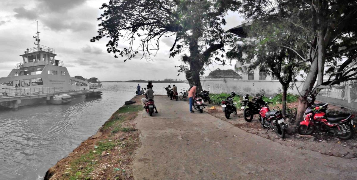
Underutilized open space that caters to disorganized parking. Photo by Rajeev Malagi/WRI India
Design Development
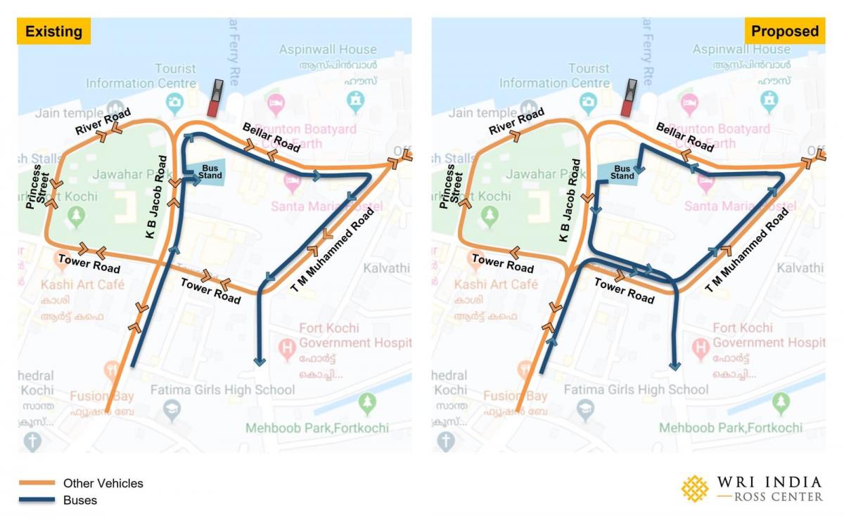
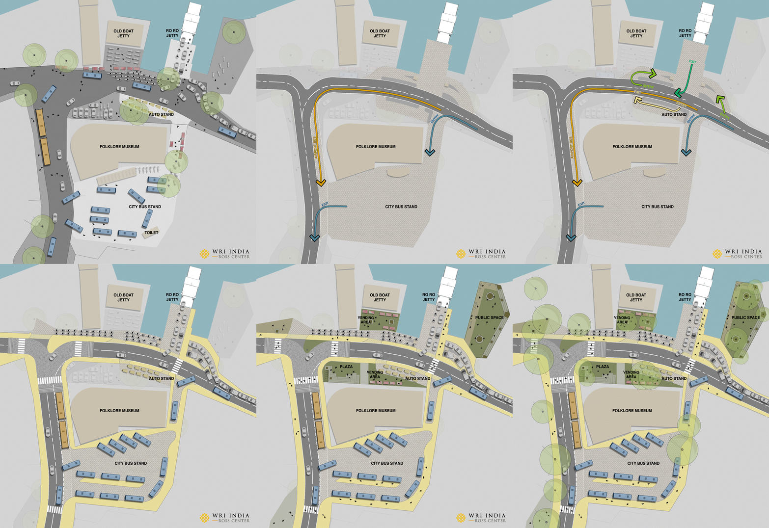
Based on these learnings, the node was redesigned with regulatory and spatial interventions such as traffic and parking management and the provision of pedestrian and public space infrastructure. The circulation was redefined by converting the streets around RoRo Jetty from two-way to one-way loops that allow private vehicles and buses to circulate in a single direction. Parking was shifted to dedicated facilities beyond immediate surroundings at a walkable distance to decongest the area and prevent conflicts.
The area was redesigned to be pedestrian friendly with streets having uniform carriageways, defined access to transit points, continuous footpaths, ample street crossings and well-provisioned open spaces to ensure accessibility.
Pilot Trial
Large-scale implementation of such a project demands time, investment, and pilot testing to ensure that these commitments are put to good use. This proposal was tested through tactical urbanism to analyze its feasibility and inform its permanent implementation.
This involved a stakeholder-led process where multiple consultations were conducted with Kochi Municipal Corporation, Centre for Heritage Environment and Development, Cochin Smart Mission Limited, Traffic Police, Motor Vehicles Department, the elected representatives, etc., to form a consensus on the proposal and seek on-ground support. Student volunteers were involved in building the space based on the proposal and managing activities during the event.

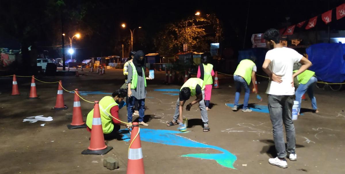
The following observations were recorded from the pilot testing:
- Defining an even carriageway, a one-way system, streamlined the traffic flow and helped reduce the volume of vehicles passing through the RoRo junction.
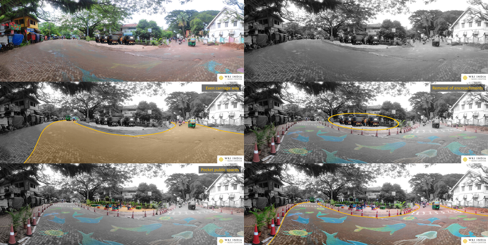
Visualization by Shabna Seemamu/WRI India, Photo by Rajeev Malagi/WRI India - Segregated entry/exit to RoRo ensured a clear carriageway allowing for a smooth flow of both the vehicles passing by and the ones exiting from the RoRo.
Visualization by Shabna Seemamu/WRI India, Photo by Rajeev Malagi/WRI India - Reclaimed pocket parks, which are public spaces at the very small scale, became pause points for people and improved the area’s vibrancy.
Visualization and photo by Shabna Seemamu/WRI India - Segregated walkways guided pedestrian movement and ensured safety by reducing vehicular-pedestrian conflicts.
Visualization and photo by Shabna Seemamu/WRI India - People consciously did not park in areas designated as ‘No Parking’ zones indicating the impact of spatial interventions on people’s behavior.
Visualization by Shabna Seemamu/WRI India, Photo by Rajeev Malagi/WRI India
Surveys were carried out during the intervention to compare before and after scenarios and evaluate the impacts. The proposal, tested and proven feasible, is now set to be taken forward by the city for permanent implementation with the support of various agencies.
The success of this project helped demonstrate that effective collaborations and people-centric approaches have the potential to create a substantial impact. It also established the need and relevance of the testing phase (tactical urbanism) in urban development processes and presented the city with a methodology that can be adopted for future projects.
Shabna Seemamu is Program Associate, with the Ross Center for Sustainable Cities, at WRI India. Views expressed by the author are personal.

