


Planning Brighter Streets in Giridih: A Data-Informed Approach
Anyone who has had to walk on a dark, desolate street can attest that street lighting contributes to a sense of safety. Ensuring proper lighting in public spaces enables mobility, social interaction and commercial activity after dark, especially in smaller towns and rural areas where public lighting infrastructure is often sparse or unreliable. And yet, India’s 35 million streetlights are unevenly distributed, concentrated around major highways and urban centers, leaving many rural roads poorly lit.
Recognizing this gap, the Jharkhand Renewable Energy Development Agency (JREDA) set a target in 2025 to install 8,000 solar streetlights across the Giridih block under the Giridih Solar City Program. Solar-powered street lighting is often seen as a sustainable, cost-effective way to expand lighting, while avoiding costly trenching for cables and reducing dependence on the electricity grid. When configured with energy-efficient LED bulbs, they can also help reduce electricity consumption by around 61% compared to their high-pressure sodium-vapor lamp counterparts.
However, as with any large-scale project, JREDA had to implement this in phases. WRI India worked with them to identify the high-priority sites through the Energy Access Explorer (EAE) — an open-source, online platform that helps users layer geospatial data on energy supply and demand to support evidence-based prioritization of energy interventions.
Prioritizing Areas for Solar Streetlights in Giridih
We ran an EAE analysis of three key indicators for this exercise: road network, population density and global horizontal irradiance (GHI). Since the intervention focused on solar streetlights, the team mapped areas along the road network, where such infrastructure could be feasibly installed. Overlaying this data with the other two indicators allowed us to map areas that have strong solar potential and can serve a larger population.
The platform generated an energy demand index to determine the suitability of different areas for deploying solar streetlights. The largest area within the block, despite having high population, fell under the medium-demand index category due to its low GHI and population density. In contrast, an 80-kilometer stretch of the road, despite serving a smaller population, had a high population density and high GHI values and was therefore categorized in the high-demand index category.
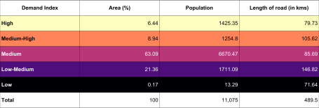
The region within the high-demand index category, with high population density and GHI, covers 6.44% of Giridih’s total land area and houses around 13% of its population. It includes several residential, commercial and connectivity zones.
Within this region, the team observed the impact of lighting on three different sites suggested by JREDA — a busy market street in the city center, a residential colony on the outskirts of the city, and a highway connecting Giridih to Hazaribagh.
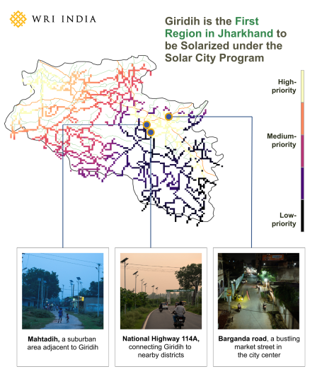
Lighting Dense Commercial Zones: Barganda Road
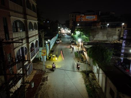
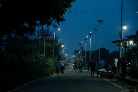
At the first site — a densely populated, commercial area — sodium-vapor lamps and ambient light from shops provide visibility in the evening. However, once shops closed, residents faced visibility issues since the network of existing street lighting was not dense or bright enough. With the installation of the new solar lights, pedestrians now move confidently during late hours, and smaller street-side vendors benefit due to increased patronship.
Ensuring Adequate Lighting for Residential Colonies on the Outskirts
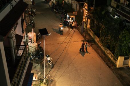
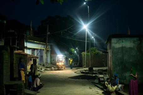
In the residential colonies at the outskirts, people used to rely on ambient light from their houses and personal lamps after sunset.
“Earlier we had to place light bulbs outside our homes at night-time, but now we no longer feel the need.”
In Mahtadih, a suburban area adjacent to Giridih but considered a de facto part of the city, the change since the new lights went up is subtle but telling — families and children can be seen walking around even after night falls.

Improving Road Visibility and Safety
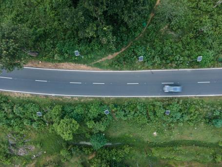
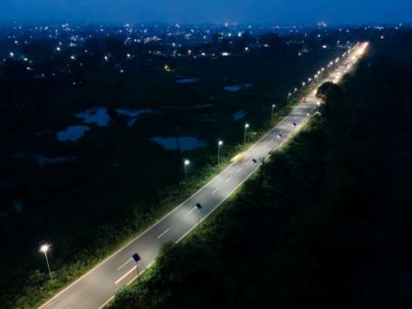
The poorly lit highway connecting Giridih to Hazaribagh used to make night-time travel hazardous. Now, along a stretch of National Highway 114A, solar streetlights form a bright path amidst the dense foliage. Improved visibility has reduced the risk of night-time accidents.
Well-lit public spaces improve safety for women, children and the elderly, while encouraging local commerce and social interaction. The data-informed approach behind Giridih’s solar streetlight installations shows how open-source geospatial tools like EAE can support decision-making for energy planning. By mapping energy demand, solar potential and infrastructure gaps, authorities can direct funds and efforts to locations where they matter most.
Photographs by Akshay Ingle and Parag Sarwade for WRI India.