
Climate-proofing Assam: A Data-driven Approach
India’s journey towards a sustainable energy transition is gaining momentum; however, it is crucial to ensure that vulnerable states and regions are not left behind. Frequented by floods, earthquakes and landslides, the state of Assam is particularly vulnerable to the impacts of climate change. According to a 2021 report, 24 of its 27 districts were classified as vulnerable to climate change. As of July 8 this year, 72 people have reportedly died in the Assam floods, with millions being displaced and facing loss of livelihood. Last year, the state saw a similar scenario, with massive and recurrent flooding across 20 districts, affecting over 1,00,000 people. This underscores the urgency to implement innovative plans and strategies that enable the state to withstand the impacts of climate change.
Recognizing this need, the Science, Technology and Climate Change Department of Assam introduced the Chief Minister’s Climate Resilient Village Fellowship Programme. This program aims to increase the awareness of climate change resilience and empower younger generations to become climate-smart leaders. It engages graduate and postgraduate students from science and engineering institutions across Assam and assigns them villages. The fellows are expected to study assigned villages and recommend climate-resilient solutions for them.
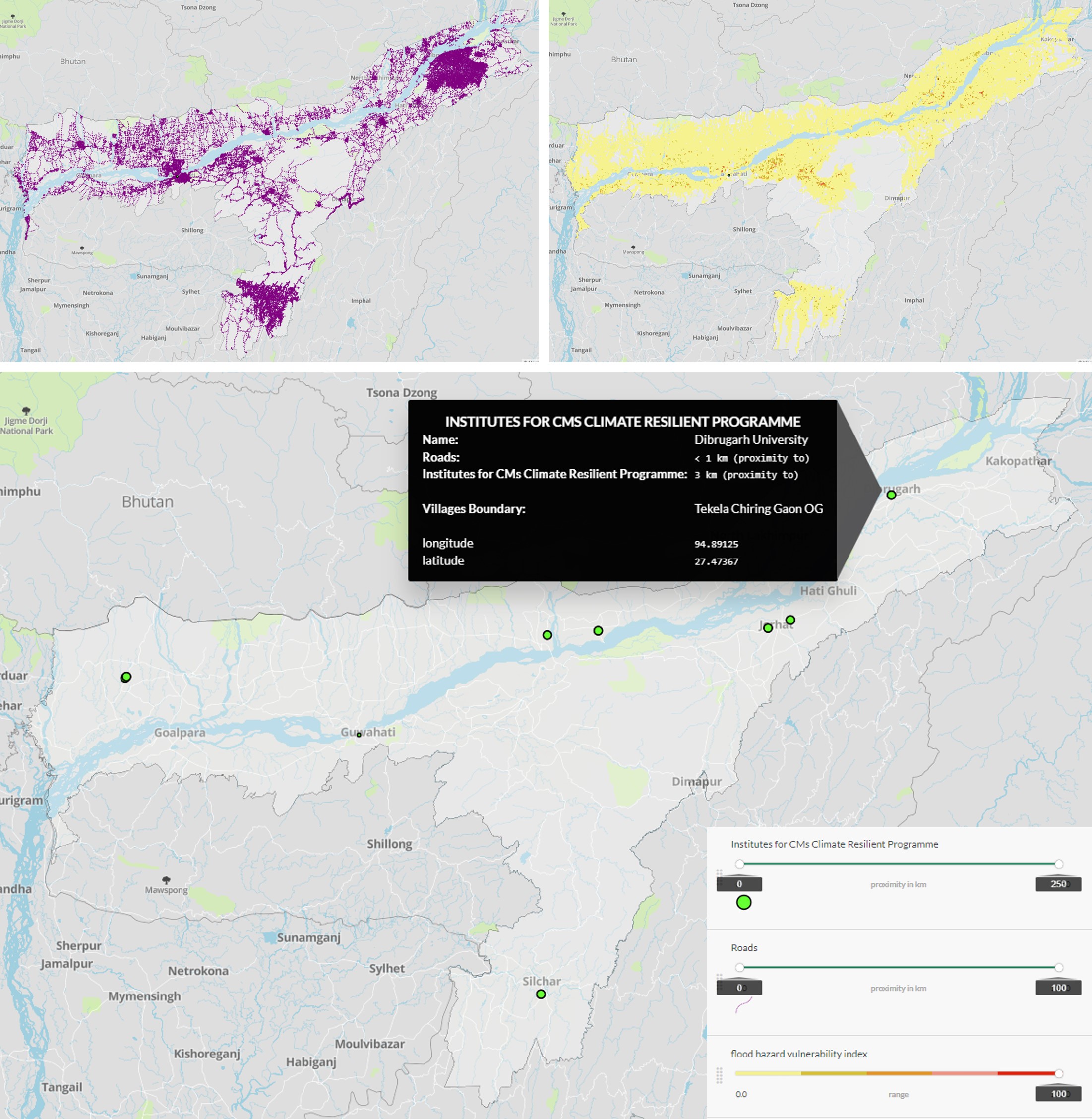
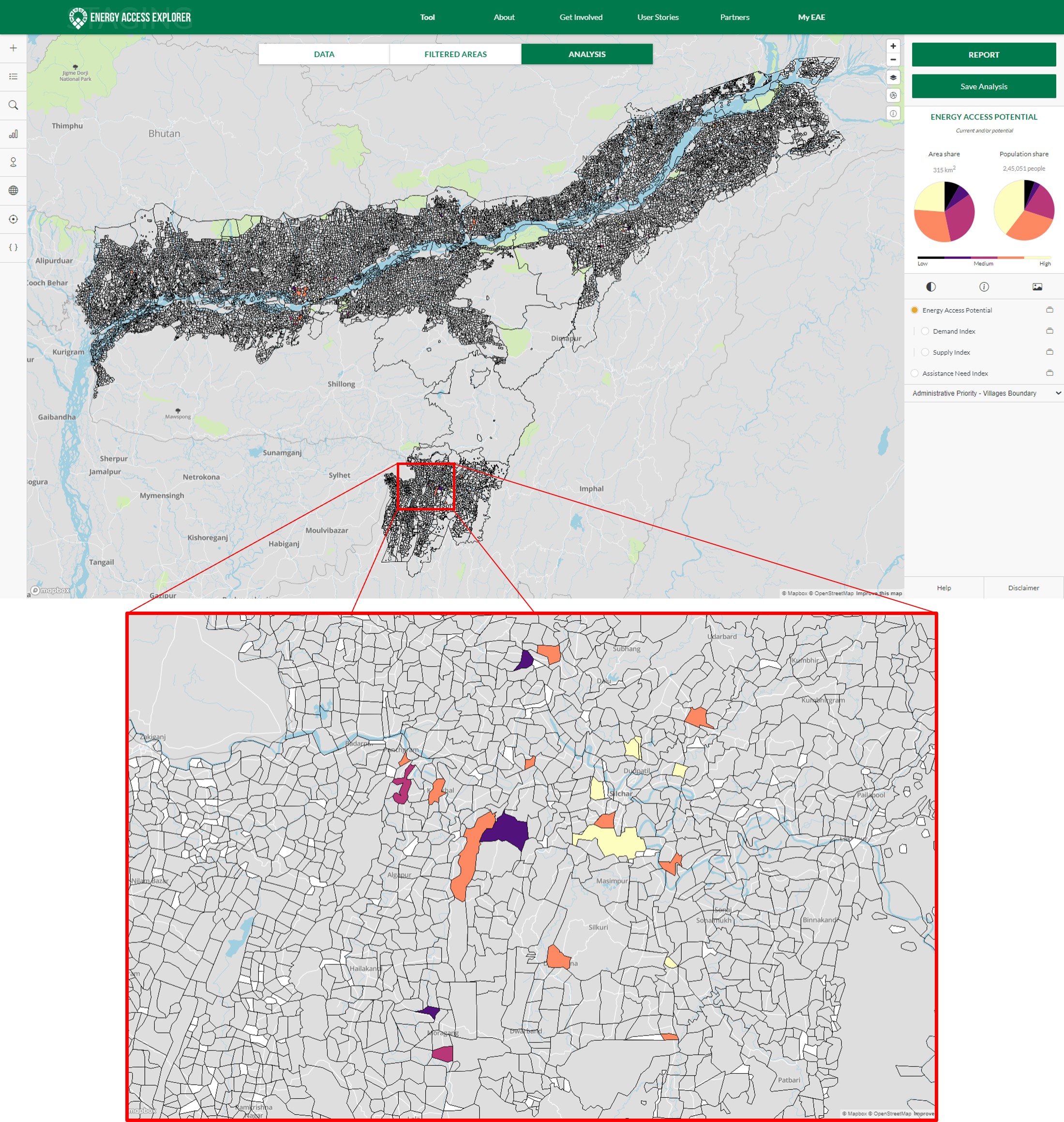
While the mentoring or educational institutions for the program were selected by the department, the selection of villages required a data-driven approach implemented through the Energy Access Explorer (EAE), an open-access geospatial tool developed by WRI India and its partners. The EAE provides comprehensive and granular data on various aspects of energy access, such as demand, supply, infrastructure and socioeconomic indicators. Moreover, it allows users to overlay this information with data on climate vulnerability such as flood risk. By using the EAE, users can identify gaps and opportunities for improving energy access and resilience in different locations.
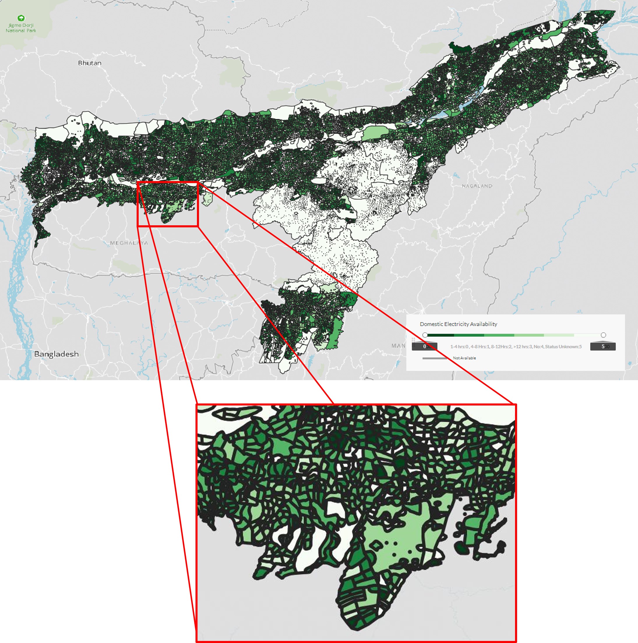
The EAE helped select villages for the fellowship program based on several criteria such as proximity to mentoring institutions, demographics, access to electricity and clean cooking, and vulnerability to floods. A few of the selections made on the EAE platform are illustrated in Figures 1 and 2. Villages within a radius of 25 kilometer of mentoring institutions, having at least 500 households and access to basic amenities, such as banks, piped water and road connectivity, were selected. High flood risk was also a criterion for the villages to be selected for developing climate-resilient solutions.
The Chief Minister’s Climate Resilient Village Fellowship Programme in Assam exemplifies the power of data-driven decision-making. By utilizing the EAE and comprehensive datasets, Assam is taking proactive steps to identify and empower vulnerable villages to become climate-resilient and energy-smart communities. This will not only enable the state to meet immediate development challenges by identifying priority areas but will also contribute to the climate-proofing of Assam in the face of climate change.
Using the EAE to identify and build resilience in vulnerable areas can serve as a model for other states to consider. Deploying various types of parameters to filter out priority geographic locations adds a spatial dimension to the data-driven analysis. This can be particularly beneficial for addressing climate change vulnerabilities. By harnessing datasets from specific regions using tools such as the EAE, site-specific plans that consider the unique challenges posed by climate change can be formulated, enhancing the effectiveness of future planning and climate resilience efforts.
All views expressed by the author are personal.
All maps are from the Energy Access Explorer (EAE). Click here to know more or try the tool.