


By the People, For the Land: Barwani's Community-Led Planning for Landscape Restoration
"I want to build a water conservation structure on every bedi (hill) in our village to catch every raindrop," said Gulalya Kanoje, the Sarpanch of Matli village in Barwani district of Madhya Pradesh, as he pointed to a map, tracing his fingers along the contour lines and discussing the runoff patterns.
The road to Matli winds through the rugged terrain of the Satpura range. The village is home to the Barela tribal community that lives across its narrow valleys and hillocks. Water scarcity has shaped life here for generations. About 65% of Barela households depend primarily on rain-fed agriculture for their livelihoods. Dry seasons and scanty rainfall render fields unproductive, forcing households into seasonal migration.
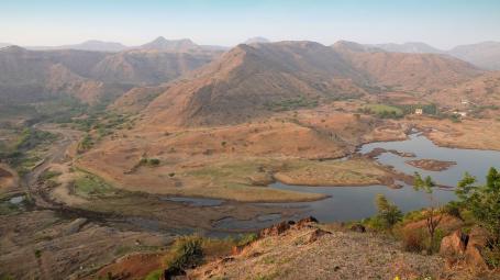
Matli’s story reflects the reality of millions of communities across India that are affected by degraded landscapes. India’s commitment to restore 26 million hectares of degraded land by expanding its forest and tree cover by 2030, presents a critical opportunity to align policies, resources and institutions towards landscape restoration.
India’s decentralized planning processes, such as the Gram Panchayat Development Plans (GPDPs), offer strong entry points for bottom-up participatory natural resource management planning. Yet planning of restoration interventions often remain fragmented or overlook the interconnectedness of water, soil, trees on farmland, agriculture and livelihoods. Matli’s journey shows how enabling local institutions and converging public schemes can support durable, community-led restoration outcomes, offering key lessons for scaling similar efforts in other regions.
Challenges in Current Landscape Restoration Planning
The Mahatma Gandhi National Rural Employment Guarantee Act* (MGNREGA) — now known as Viksit Bharat–Guarantee for Rozgar and Ajeevika Mission (Gramin) Act, 2025 (VB-GRAMG Act) — offers immense potential for landscape restoration. Nearly 60% of its funding is reserved for natural resource management (NRM). Yet the utilization of the allocated budget for integrated landscape planning has been sub-optimal.
While MGNREGS allocates a significant share of expenditure to natural resource management, several studies, as well as WRI India and Transform Rural India (TRI)’s experience of working in Barwani, suggest that the focus is on outputs rather than ecological outcomes. Although substantial funds are directed toward water structures in the district, emphasis has been on specific asset types such as farm ponds or check dams, instead of comprehensive area treatment across the full watershed terrain.
Fragmented planning shows up in the separate drafting of the Village Prosperity Resilience Plan (VPRP), Gram Panchayat Development Plans (GPDPs) and MGNREGS labor budgets. These are rarely informed by hydrology, soil behavior or watershed priorities. Women’s collectives are deeply affected by water scarcity but are seldom part of formal decision-making. Long-term maintenance support after the construction of NRM assets remains limited. The result is scattered assets, short-lived impact and missed opportunities for integrated restoration.
How Barwani is Reshaping Landscape Planning
In 2023, Barwani district began shifting towards a landscape planning approach that integrates ecological conservation, livelihoods and human development across entire landscapes.
A Landscape Restoration Nudge Unit, led by WRI India and TRI, conducted capacity-building workshops for sub-engineers from MGNREGA office and representatives from Matli Gram Panchayat. The goal was to align local knowledge with spatial data so planning decisions reflect both scientific inputs and the land’s ecological and livelihood needs.
During the January 2024 Gram Sabha in Matli, women from self-help groups, farmers and other residents used rangoli-style resource mapping to identify drainage paths, existing structures, forests and farms in their village. The process helped the community members voice their priorities in an accessible and inclusive manner.
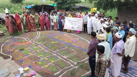
“Earlier, we were never involved in the village's natural resource planning. The gram panchayat made those decisions. Over the past two years, rangoli mapping and Geographic Information System (GIS) maps have created space for us to participate and share our views. We now lead the rangoli mapping and identify priority areas for intervention,” said Jasma Kanoje, a member of the self-help group.
A year later, during the 2025 planning meeting, the community adopted GIS tools to identify locations for landscape interventions. The contours, drainage lines and slopes, and ecological systems that emerged in these maps helped the community revisit their planning decisions.
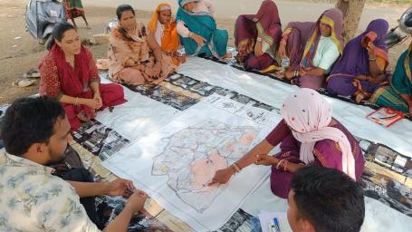
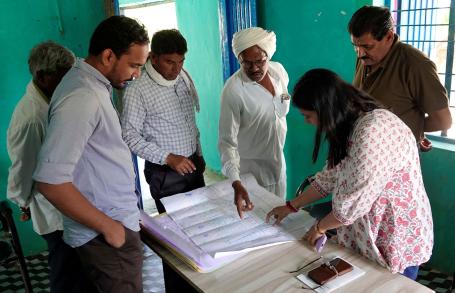
Vikas Desai, an MGNREGS sub-engineer trained during the process, moved away from standard digital files that map structures on satellite imagery. “We presented a printed, banner-style GIS map showing khasra number (number allotted to plot in revenue records) contours and drainage lines,” he said. “It was easier for villagers to understand and made planning more accessible, leading to greater community participation,” Vikas added.
“The GIS map helps us identify priority areas and assess existing and new water conservation structures to prepare a comprehensive plan for Matli Gram Panchayat,” said Gulalya Kanoje, pointing to the maps displayed in the panchayat office.
Over the past two years, Matli Gram Panchayat along with Self-help Groups (SHGs) has collectively integrated its restoration priorities into the MGNREGS labor budget, ensuring coherence across the planning processes of GPDP and VPRP. Around INR 20 lakh has been invested in restoration interventions, such as farm ponds, ground water recharge interventions and plantations on farmlands. These efforts have brought over 10 hectares of degraded land under restoration, improving surface water availability, reducing seasonal migration and strengthening agricultural resilience, while creating green jobs and fostering community ownership of natural assets.
Lessons for Scale-Up
Matli’s experience shows the value of blending traditional knowledge with digital tools for climate-resilient planning. It demonstrates how aligning institutional mandates (MGNREGS and Madhya Pradesh State Rural Livelihood Mission), GIS tools and community leadership, especially by women, can transform restoration from a scheme-driven activity to a locally owned process.
To mainstream community-led landscape restoration across policy, planning and practice, we must build capacity across institutions for participatory planning. This can be done using GIS tools and convergence strategies that align with existing public programs, incentives and policies, and by strengthening the participation of community groups and SHGs.
Landscape restoration is a continuous, evolving process that requires strong adaptive management — where plans are regularly refined based on seasonal changes, on-ground feedback and community needs. Villages need an enabling and supportive environment to sustain and scale their restoration efforts. With consistent support, adaptive planning and collaborative actions, communities can turn fragmented efforts into an integrated and institutionally scalable model of landscape restoration for India.
*This blog uses the original name, MGNREGA (or MGNREGS), as the field experiences and insights are from June 2023-November 2025, before the transition.
Sanket Aher worked in the Barwani district of Madhya Pradesh with Transform Rural India (TRI) as a practitioner in a landscape restoration project led by WRI India in collaboration with TRI.